Guía de viajes de Cusco
CUSCO INFORMATION
RELIEF AND GEOLOGY
Cradle of the ancient Inca empire and widely known in the world for having stunning architecture and archaeological remains, Cusco is the fourth largest department in Peru, after Loreto, Ucayali and Madre de Dios, and, due to its breadth and position Geographical, it is also a window to the southern jungle of Peru.
Cusco is located in the heart of the southern highlands of Peru. It borders seven departments: to the north it does so with Junín and Ucayali; on the east, with Madre de Dios and Puno; on the south, with Arequipa and on the west, with Apurimac and Ayacucho. With an extension of 71 986.50 square kilometers, the physical environment of Cusco is extremely varied, since it combines mountain alignments, knots, plateaus and plateaus, as well as deep valleys and canyons.
Broadly speaking, Cusco can be visualized as a sloping territory that has the highest altitudes in its southeast sector, where manifestations of puna and the watershed divide that separates it from the hydrographic basin of Titicaca are located. Following the course of the Urubamba River, its lowest altitudes are to the northwest, in areas that are below 400 meters above sea level due to its great altitude differences, the department has 7 of the 8 regions that the model of Pulgar Vidal proposes for Peru, this is, fluvial Yunga, quechua, suni, puna, junca or cordillera, omagua and rupa rupa.
The geology of the department is varied. Crossing from northeast to southeast the entire extension of the department, there is an ancient formation associated with the lower Paleozoic and that makes up one of the oldest groups in its territory (more than 400 million years old). Part of this group, located in the Vilcabamba Mountain Range, belongs to the Ordovícios sediments (between 400 and 500 million years old).
In opposition, in the southwestern corner of its territory, very recent manifestations of the quaternary are also located (less than a million years), associated with the glacial deposits typical of the Andean highlands.
The marked Andean uprising, together with the abundant supply of water as a result of the great activity of the glaciers in the last million years, caused the strong wear and tear of the ancient Andean plateau, of which the so-called residual mountainous areas, such as the Valcaconga, of lower altitude and whose greatest expression is found in the Wanacure hill, 4 089 m.
Goemorfológicamenete, the southern part of the department is linked to the high Andean plateaus that are located above 3 80 meters. Among the most important are the Yauri plateau and the Siwinacocha and Orangote plateaus. The undulating configuration of these spaces has favorably affected the economy and way of life of the area, since its soils make up the ideal space for the development of natural pastures, food for the Andean camelids, abundant in this area.
This sloping territory is in turn defined by the central and eastern chains of the Andes of central Peru. These chains are segmented by the erosion of the rivers and they, in turn, make up local chains. The most important of these, which define the territory of Cusco, are the Vilcabamba mountain range, the Vilcanota mountain range and the Paucartambo mountain range.
The Vilcabamba mountain range, located to the northwest of the department, is generally aligned in a southeast-northeast direction. The rivers and streams that make up the Apurimac River precipitate along its western flank, while the tributary waterfalls of the Urubamaba are located along its eastern flank. Among the highest elevations in this chain are the snowy Salcantay (6,271 m), the Pumasillo (6,070 m) and the Sajsarayoc (6,050 m).
The Vilcanota mountain range, aligned to the east of the river of the same name, is home to the snowy Ausangate (6,372 m), which is the highest point in the department and the fourth highest in Peru.
With a lower average altitude, the Paucartambo mountain range is located to the east, on the border with the Madre de Dios region. The environment of the Vilcanota knot, to the southeast of the department, is of first-rate importance, as it constitutes the landscape genesis in terms of relief and water. In this place the main lagoons are located, which, together with the thaws, help to form the headwaters of the rivers. These lagoons are those of Languilayo, in the province of Canas; Sibinacocha, in the province of Canchis, and Salunta, in that of Espinar.
It is also due to its high altitude that in the eastern sector the relief formations characteristic of the puna, of great economic importance, are present. Its undulating relief and covered with high Andean natural pastures allows the development of a large cattle ranch of South American camelids.
The weather:
It is subordinated to the conditions of altitude and relief. In this sense, and due to the enormous variety of altitudes, the Cuzco territory boasts a wide range of climates where the dependent variable is temperature.
This wide variety of climates, ranging from perpetual high mountain snow (southeast) to savanna (northwest), in turn, encourages an adaptation of natural vegetation to the conditions imposed by the environment. The upper parts are the domains of grasses and natural pastures, while in the lower parts of La Convencion there is a tropical savanna landscape with rainfall in the southern summer and dry season from April to September.
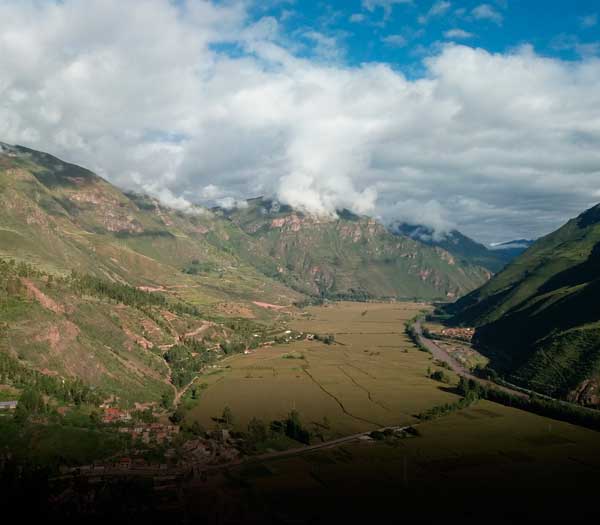
With regard to the organization of space, two are the most important valleys in the department: the Urubamba and the Apurímac.
The first, which mails from the southeast to the northwest as a backbone of the department, is also its economic, demographic and productive column. The Urubamba basin contains more than 80% of the cultivable soils, which are, at the same time, the most fertile in Cusco.
The Apurimac valley is narrow and with a very steep slope when compared to the previous one. It is located in the western part of the department. The river that gives it its name serves as the boundary between Cusco and the departments of Apurimac and Ayucucho. The Apurimac basin contains 17% of the department’s productive soils. To the east, in the province of Quispicanchis, the sources of the rivers that feed the Inambari and Madre de Dios basins are located, which have only 1% or 2% of the productive soils.
The variety a Cuzco range favors a wide range of crops. In the high Andean zone, tubers and legumes predominate; in the sheltered valleys, corn and wheat; and in the lower parts of La Convencion and Paucartambo, coffee, cocoa and tea are preferably planted.
It is the tourist activity, however, which generates the highest income in the department, although it is concentrated in the city of Cusco and the tourist circuit that makes up the so-called Sacred Valley. Thus, in 1999, Cusco registered the number of 389,409 visitors, of whom 219,198 came to visit the archaeological complex of Machu Picchu.
HYDROGRAPHY.
The structural dominance imposed by the relief largely determines the path of the waters that irrigate and shape the landscape of the department of Cusco. It is the western, central and eastern chains of the central Andes that, in their parallel route, establish the course of the two most important rivers: the Vilcanota – Urubamba and the Apurimac.
Vilcanota, known by this name from its springs in the thawing of the Cunurana mountain, at 5443 masl, crosses the Quequepampa plateau and begins a marked decline in a northwesterly direction, receiving on the way numerous contributions, of which the most important, On its right bank, it is the Salca river, a basin contained in the province of Canchis. Vilcanota continues its journey forming a valley that has historically been very populated and passes 15 km from the city of Cusco, with which it is linked through the tributary known as the Huatanay River.
Vilcanota begins to be called Urubamba when entering the province of this name, and will continue to be called that way for the rest of its route until it meets the Tambo. From this union the Ucayali is born, the main tributary of the great Amazon.
The Urubamba maintains, in general terms, a southeast-northeast direction up to the height of Quillabamba. To the north of this town the river changes direction, heading southwest – northeast until it receives the waters of the Yanatili, which is when it takes an east-west direction, a course that it maintains until it receives the waters of Campirusanto. From this point it heads in a southeast-northeast direction, which will continue until it meets the Tambo river. When the Paucartambo river discharges its waters into the Urubamba, the latter has an average width of between 100 and 300 m. a few kilometers north of this point the river begins to box to form the imposing pongo de Mainique: there the channel narrows to almost 30 meters and the current becomes very intense in the two kilometers in which the slope is very marked.
Culminating the pongo, at the entrance of Tonquini, the Urubamba recovers the typical tranquility of the rivers of the low jungle and crosses the valley of La Convencion. This area, in addition to being suitable for the cultivation of tropical products, such as coffee, tea and cocoa, also has a wide forest potential.
The Vicanota – Urubamba that runs 862 km from its sources to its confluence with the Tambo, ranks sixth in length between the rivers of Peru, preceded by the Ucayali, the Mrañón, the Putumayo, the Yavarí and the Huallaga. It is also the most important axis of the inter-Andean region of southern Peru, articulating throughout its journey – from time immemorial – numerous human groups. Vilcanota – Urubamba is so important that its confluence with the Tambo River forces it not only to change its course, but also its name: it is called Ucayali.
Vilcanota – Urubamba flow is variable, since it depends on the place and time of year in which the measurement is made. It has a similar behavior to most of the rivers of the eastern slope, which increase their loads in the summer months, favored by thawing, and have their moments of minimum flow in the winter months. At the Pisac station, kilometer 108, the historical measurements carried out tell us that the months with the lowest average flow are August and September, with a record of 30 cubic meters / second, and the month of May is February, when it frequently exceeds 350 cubic meters / second.
The Apurimac springs are considered the most remote arms of the Amazon. The route of the Ucayali – Apurimac river from its most distant springs, in the heights of the Areuqipa department, reaches 3,000 kilometers. With this length it would be located in position twenty among the longest rivers in the world. These springs are located north of the town of Chivay, capital of the Cailloma province, on the eastern slopes of the southern western Andes. Although there is no consensus, according to Carlos Peñaherrera, these springs are located in the glacial lagoons of the northern sector of the Mismi mountain. This water course heads north and crosses the Cailloma and Espinar plateaus, where it is already known as Apurímac.
In its rapid descent, the Apurímac flows through the Espinar, Canas and Papuro provinces, where it receives the waters of the Santo Tomás river. From this point, and for almost 100 kilometers, the Apurimac delimits the departments of Cusco and Apurimac. Downstream, and in the form of two colossi that are found, the Apurímac receives the waters of the Pampas river and as a result it is redirected towards the northeast, delimiting the departments of Cusco and Ayacucho.
ECOLOGY.
Cusco is one of those departments that have it all. A sort of miniature country, in which dozens of landscapes, climates and reliefs converge, making its territory a true delight for travelers.
From the perspective offered by satellite images, the department appears as a territory almost bisected by two large mountain ranges: the Ausangate massif, to the west, and the Salcantay massif, to the east. The two chains are, in turn, separated by the broad valley of Vilcanota or Urubamba, the “sacred river of the Incas”, which runs from north to south “splitting” the departmental surface into two halves.
The result, seen from an imaginary location a few hundred kilometers from the ground, is a territory divided into four parts or sections, the same that could well be considered the department’s new ecological ones.
The first of these is to the southwest and comprises the highlands of the provinces of Anta, Espinar, Acomayo, Paruro, Chumbivilcas. This is a region of mountains covered by natural pastures and of narrow and deep valleys, where erosion shows the vestiges of a violent and constantly dynamic geological past. Here the great Apurimac is born, which runs through the grazing areas of the large herds of camelids.
A second “quadrant” is located to the southeast, defined by the territories of the Apu Ausangate (Canchis and Quispicanchis provinces). Snowy mountain ranges, lagoons of indescribable beauty and extensive bogs where time seems to have stopped. This is possibly the most inaccessible and unknown region in the department.
It is not for nothing that it continues to be the ancestral territory of indigenous groups (such as the K’ero) that maintain traditions that date back to pre-Columbian times. The ecosystems here are diverse: from the eternal snows to the foothills of the eastern slopes, but always marked by majesty and isolation.
The third zone is located to the northeast and covers part of the provinces of the Convention, Calca and Paucartambo. These are mountain forests that constitute the headwaters of the Marcapata, Paucartambo and Madre de Dios rivers. The mythical Amarumayo region, or “river snake” of the Incas, covered with impenetrable forests and populated with extraordinary biological diversity. The southern sector of the Manu National Park is also located here, with its cloud forests, considered among the richest on the planet.
Finally, there is the extreme north-west that extends over the jungle lands of La Convencion. Ancestral territory of the matzigenka; an exuberant and unknown region, chosen by the last Incas to protect themselves and try to reconquer their empire. Vilcabamba and Quillabamba are lands of coffee and coca, of fruit trees and achiote. Region of torrential rivers and ponchos that take your breath away. This is, without a doubt, the tropical face of Cusco.
HOLIDAY CALENDAR – CUSCO.
January:
Date Place Holiday
1 Jan Around Cusco Delivery of poles (change of command of the mayors.
3 Ene Province of Cusco The Lord of Calvary.
3 Jan Poroy The Sweet Name of Jesus.
3 Jan The Convention Party of the Lord of the Cabildo.
Jan 6 Anta, Ollantaytambo, Patacancha. Descent of the Magi.
14 Jan Canas San Hilario.
17 Jan Acomayo, Cusco, Cusipata San Antonio Abab.
Jan 20 Chumbivilcas, Canchis, Cusco, Paruro. Saint Sebastian.
Jan 24 Canchis. The Virgin of Bethlehem.
February:
Date Place Holiday
Feb 2 Various Provinces. Candelaria festivities.
Feb 3 Cusco (San Blas). The sweet name of Jesus.
Movable All provinces. Carnivals, Yunzas (cuts mountains, gastronomic, dance competitions, etc.)
March:
Date Place Holiday
08 Mar Urubamba (Urquillos) Agricultural Fair.
19 Mar Urubamba San José.
Movable Easter. Holy Monday: procession of the Lord of Tremors, patron saint of Cusco. Good Friday: procession of the Holy Sepulcher and the Virgin of Sorrows.
May:
Date Place Holiday
1 – 3 May Various Provinces Fiesta de la Cruz (cruzvelacuy).
Movable Ocongate. Q’oyllur Riti pilgrimage (snowed Ausangate) and Alasitas fair.
May 15 Various Provinces. San isidro labrador.
June:
Date Place Holiday
Moveable Cusco. Corpus Christi procession.
8 Jun Apurimac Canyon. Qheswa Chaca Folk Festival.
Ollantaytambo. Ollantay Raymi Festival.
Jun 13 Acomayo, Anta, Calca, Quispicanchis San Antonio.
Jun 14 Urubamba. The Lord of Torreschayoc.
Jun 21 Raqchi. Craft festival and folkloric contests.
Jun 21 Cusco (San Blas). Feast of the Virgen del Buen Suceso.
Jun 23 Cusco. Jubilee week, parades, contests and fireworks.
Jun 24 Cusco. Inti Raymi on the esplanade of Sacsayhuaman.
Jun 24 All provinces. San Juan.
Jun 29 Chumbivilcas. Saint Peter.
Jun 30 Quispicanchi. Eighth of San Juan.
July:
Date Place Holiday
Week of Jul 15 Paucartambo. Feast of the Virgen del Carmen.
Jul 16 Provinces. Virgen del Carmen.
25 – 29 Jul The Convention. Coffee Party. Horse races, dances, gastronomic festivals.
Jul 25 Anta. Horse race and rooster tipiy.
Jul 25 Calca, Canas, Canchis, Quispicanchi. Santiago party.
Jul 25 Chumbivilcas. Feast of Santo Tomás.
Jul 26 Cusco. Feast of Santa Ana.
Jul 28 All Peru. National holidays, parades.
Jul 29 Paruro. Bullfight.
Jul 31 Diverse communities of the department. Tinka (baptism) of the gando, corpus of Santiago, corpus of Santa Ana.
August:
Date Place Holiday
1 Aug Diverse communities in the department. Earth day.
2 Aug Calca, Urubamba. Our Lady of the Angels.
4 Aug Cusco. Corpus of San Cristóbal.
4 Aug Cana, Canchis, Quispicanchis. Our Lady of the Snows.
10 Aug Canchis. Feast of San Lorenzo.
12 Aug Chumbivilcas. Tinka (christening) of cattle.
12 Aug Canas. Santa Clara party.
14 Aug Calca (Pisac). Huanca Fair.
15 Aug Calca. Virgin Asunta Feast.
15 Aug Canas, Urubamba. Fair.
24 Aug Calca, Canchis. San Bartolome.
30 Aug Almost all the provinces. Santa Rosa de Lima.
Moveable Cusco. Huarachíkuy.
September:
Date Place Holiday
8 Chumbivilcas Set. Patronal feast.
8 Set Urubamba (Chinchero). Virgin of the Nativity.
14 Set Anta (Mollepata). The Lord of Exaltation.
14 Set Pisac. Feast of the Lord of Huanca. Pilgrimage from Cusco to the sanctuary.
21 Gray Set. Saint Matthew.
30 Set Cusco. Feast of San Jerónimo, Corpus de La Almudena.
30 Set Cusco (Oropesa). Bread Festival.
October:
Date Place Holiday
Oct 4 Canchis, Quispicanchi, Urubamba. San Francisco.
Oct 10 Almost all the provinces. Feast of the Virgen del Rosario.
Oct 11 Canchis. San Miguel.
Moveable Cusco. Tourist week.
18 Oct Canas. Saint lucas.
Oct 31 Cusco (San Sebastian). Christ the King.
November:
Date Place Holiday
1 – 2 Nov Cusco. Feast of All Saints and Days of the Dead. Food festivals and preparation of so many wawas (bread dolls).
Nov 5 Canchis. Town fest.
14 Nov Canas. The Exaltation of the Lord.
Nov 18 Acomayo. Commemoration of the uprising of Túpac Amaru.
December:
Date Place Holiday
Dec 4 Cusco (San Sebastian). Feast of Santa Barbara.
Dec 6 Canchis. St nicolas.
Dec 8 Almost the entire department. The Immaculate Conception.
Dec 13 Quispicanchi. Indian descent.
Dec 15 Calca, Pisac. Bernardo Tambo Huaqso Pumallali Folk Festival.
Dec 18 Cusco. San Blas.
Dec 20 Quispicanchis. Gastronomic festival.
Dec 24 Cusco. Santuranticuy. Craft fair of religious images.
Dec 24 Chumbivilcas. Tacanacuy.
Dec 25 Christmas.
Dec 31 Quispicanchi. El Niño Huayna Capac.
-
Tourist packages to Cusco, Machu Picchu
Live the magical experience of discovering Cusco, Machu Picchu and its surroundings. Make the most of your vacation time.
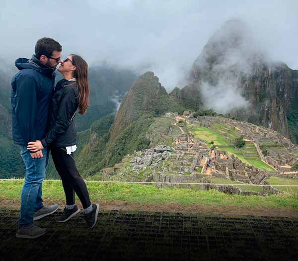
Cusco + Sacred Valley + Machu Picchu
7 Days / 6 Nights
From:
$ 599.00
Sacred Valley + Machu Picchu
5 Days / 4 Nights
From:
$ 459.00
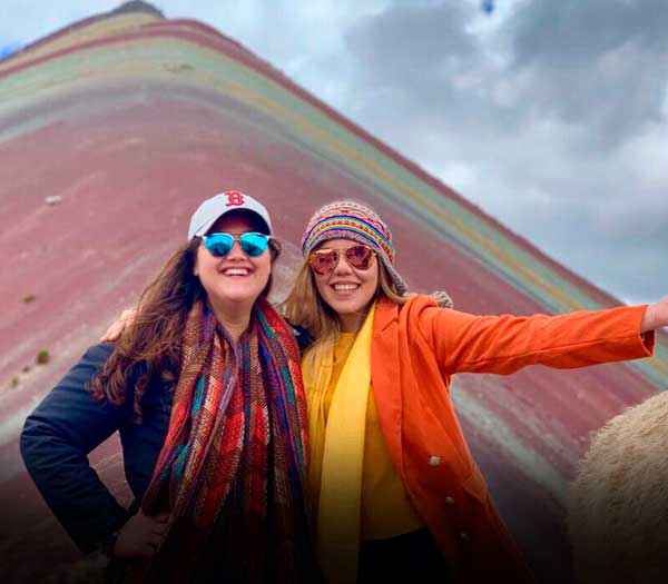
Machu Picchu + 7 Colors + Humantay
8 Days / 7 Nights
From:
$ 659.00
-
Our country is incredible. Discover Peru!
Peru is a wonderful country, with a territory full of natural and archaeological attractions. In addition to exquisite cuisine and human warmth.
Tour to Lima + Cusco + Machu Picchu
9 Days / 8 Nights
From:
$ 839.00
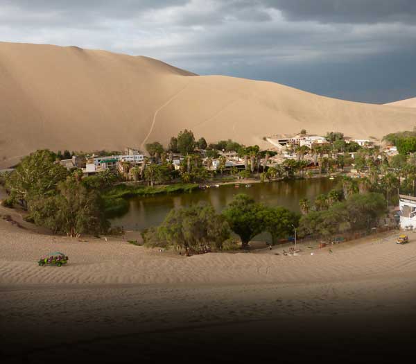
Tour Lima + Huacachina + Cusco + Machu Picchu
10 Days / 9 Nights
From:
$ 1,049.00
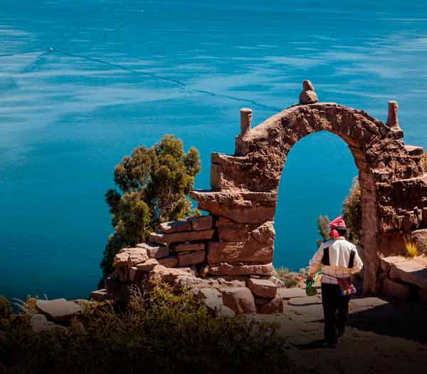
Tour Lima + Machu Picchu + Lake Titicaca
11 Days / 10 Nights
From:
$ 1,029.00